|
While our images are electronically watermarked, the antique prints themselves are not.
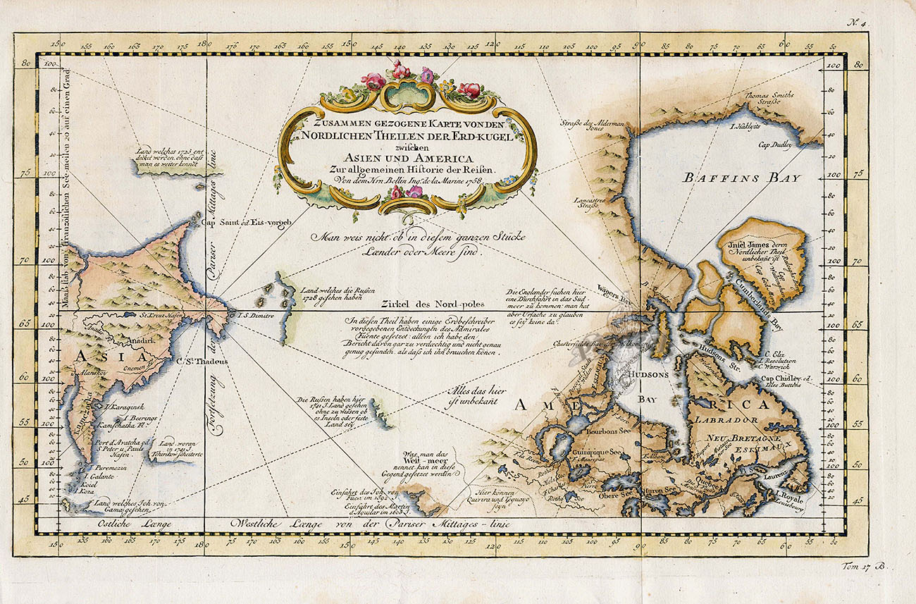
Bellin Copper Plate Map of the Arctic, Asia, Pacific
Northwest America 1758 BMI1 $595
This map of the Arctic by Jacques Nicolas Bellin was published by Arkstee & Merkus in Liepzig in 1758. It was part of Allgemeine Historie der Reisen, the German edition of Prevost d'Exile's Histoire Generale des Voyages.
It is a copper plate engraving in excellent condition measuring 9 1/2 by 14 3/4 inches with later hand colouring. The upper right corner has a small foxed area as shown.
The uncommon chart shows only the northeast coastline of Canada with Baffin and Hudson Bay and the St. Lawrence River. On the other side is the northeast coastline of Asia with the Kamchatka peninsula. In between are a few small areas of coastline with notations concerning reported explorations, including those of Juan de Fuca, the Russian expeditions in 1728 and 1741, the reported West-meer (Sea of the West) and the English quests for a Northwest Passage via the Hudson Bay.
We accept credit cards & PayPal. Florida state residents pay Florida state sales tax. Shipping for this item is $15.95. Items can be combined to save on postage. International shipping starts at $35 and buyers are responsible for all customs duties. Our environment is smoke free. We pack professionally using only new materials. All items are beautifully wrapped and suitable for sending directly as gifts. You may return any item within 14 days if not satisfied. To order, you may call us at 1-888-PANTEEK, or send email to panteek@aol.com

PANTEEK is a registered trademark

  
|